

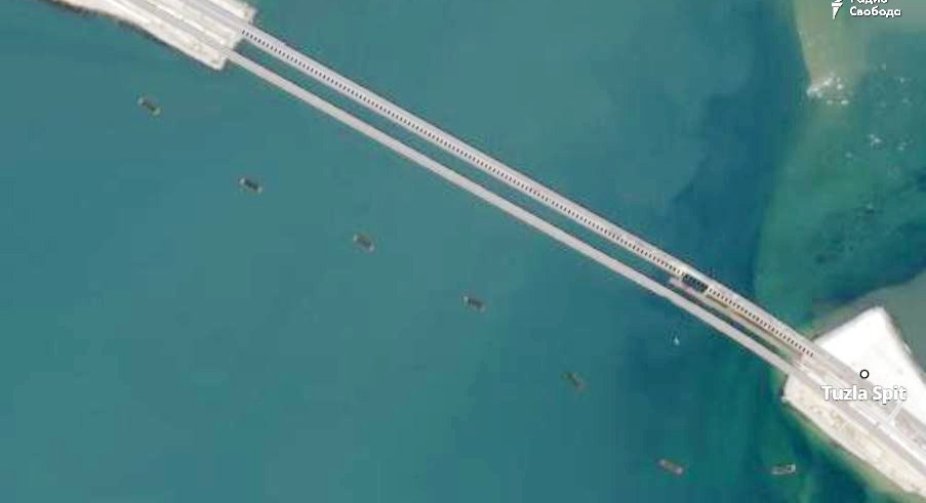

Radio Liberty has published photos from the Planet.com satellite service showing boats blocking the approaches to the Crimean bridge.
The high-resolution satellite images show that there are barges to the south of the bridge, possibly partially submerged (the depth in this area is 2-4 meters).
These barges could be used as the basis for a barrier to prevent Ukrainian maritime drones from passing through.